Advanced LiDAR Solutions for Rapid and Precise Measurements
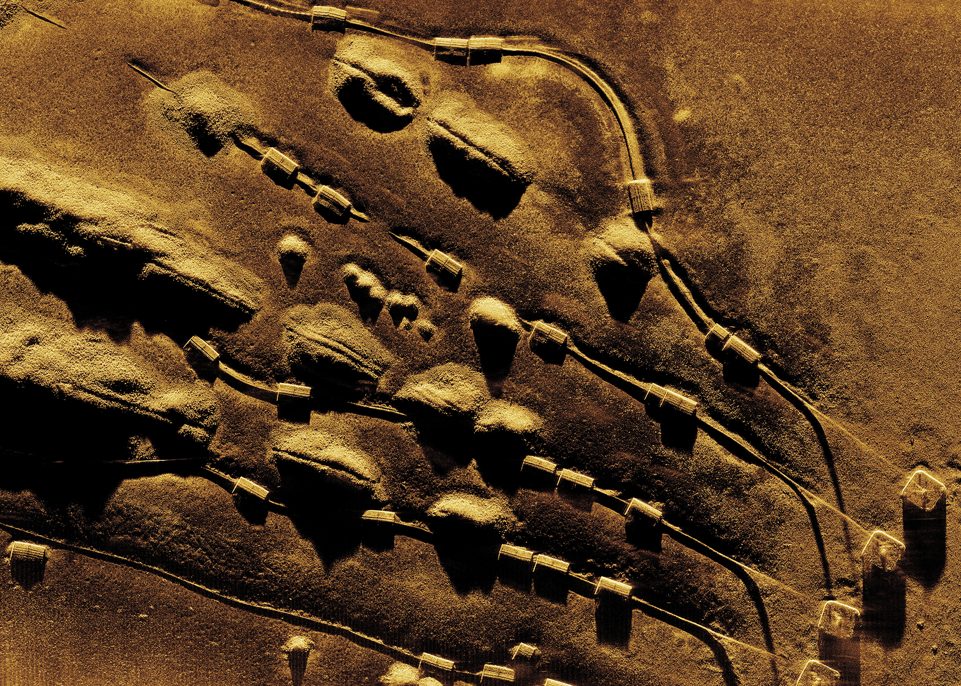
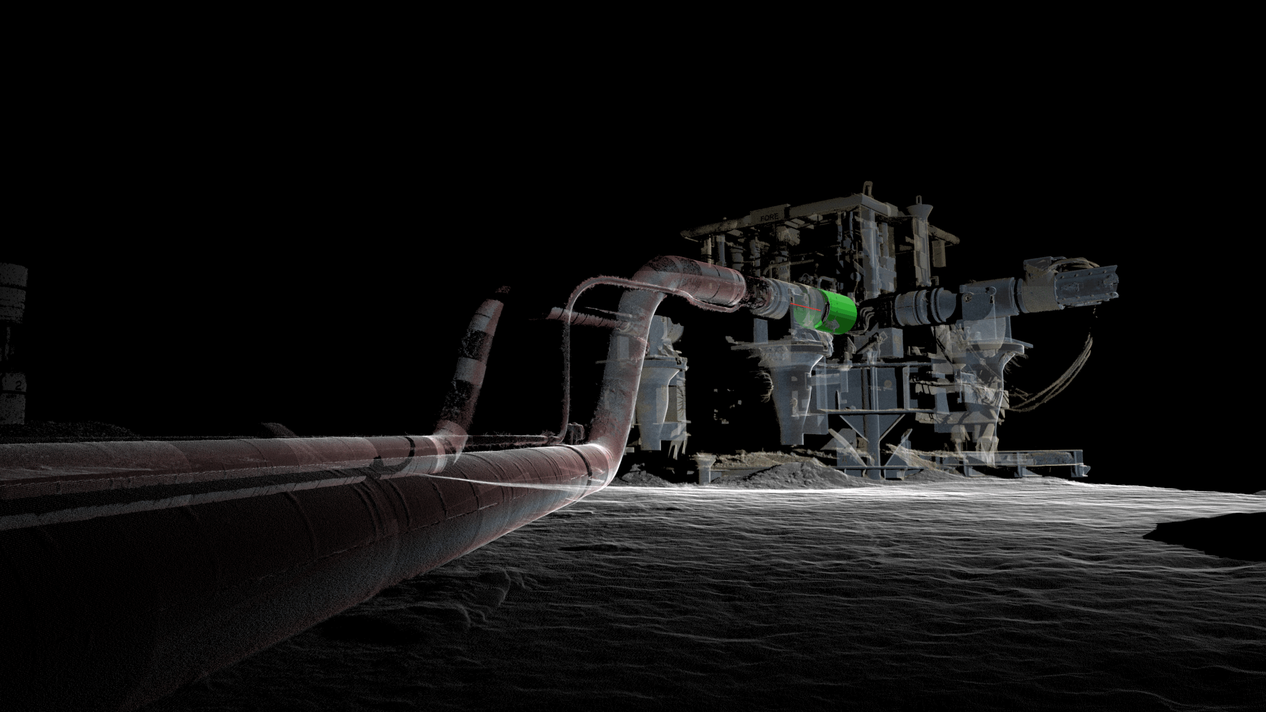
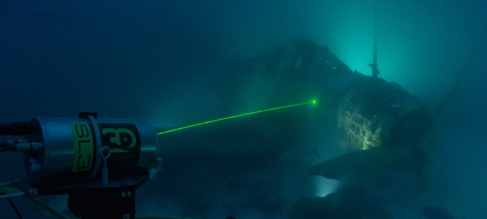
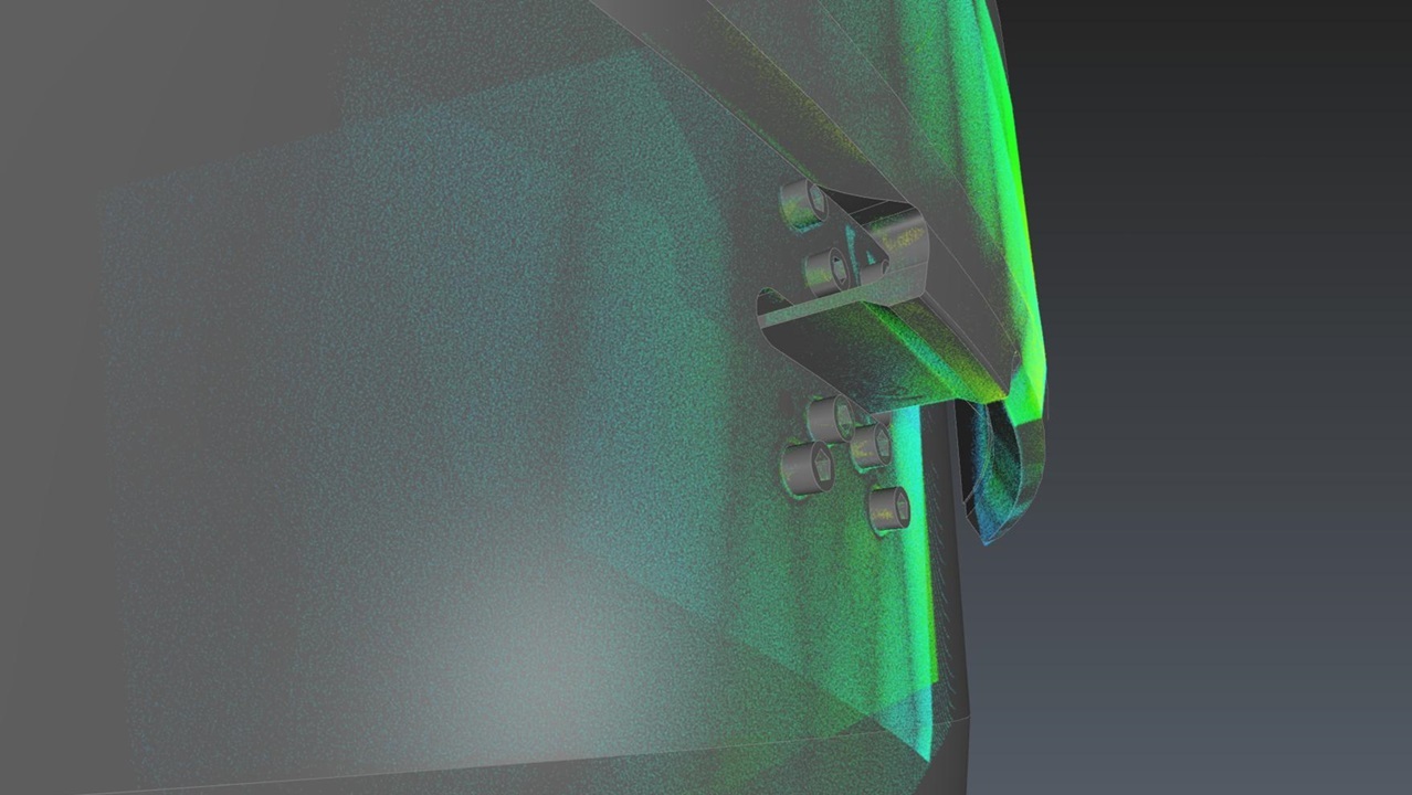
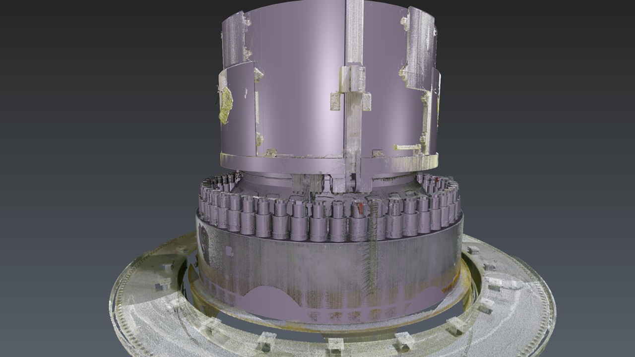
Kraken LiDAR solutions deliver high-precision inspection and monitoring of underwater assets and environments to support informed decision-making. Our technology enables rapid, millimetric-accuracy seabed mapping, 3D digital twins, and infrastructure modeling from stationary or mobile platforms. Contactless measurements from 10+ meters away decreases risk of damage to assets and disruption to operations. From nuclear structure inspections to imaging subsea infrastructure at depths of 4,000 meters, Kraken Subsea LiDAR provides engineering-grade 3D data that reduces risk in underwater installations and inspections.
Unparalleled Precision
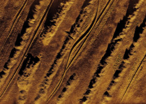
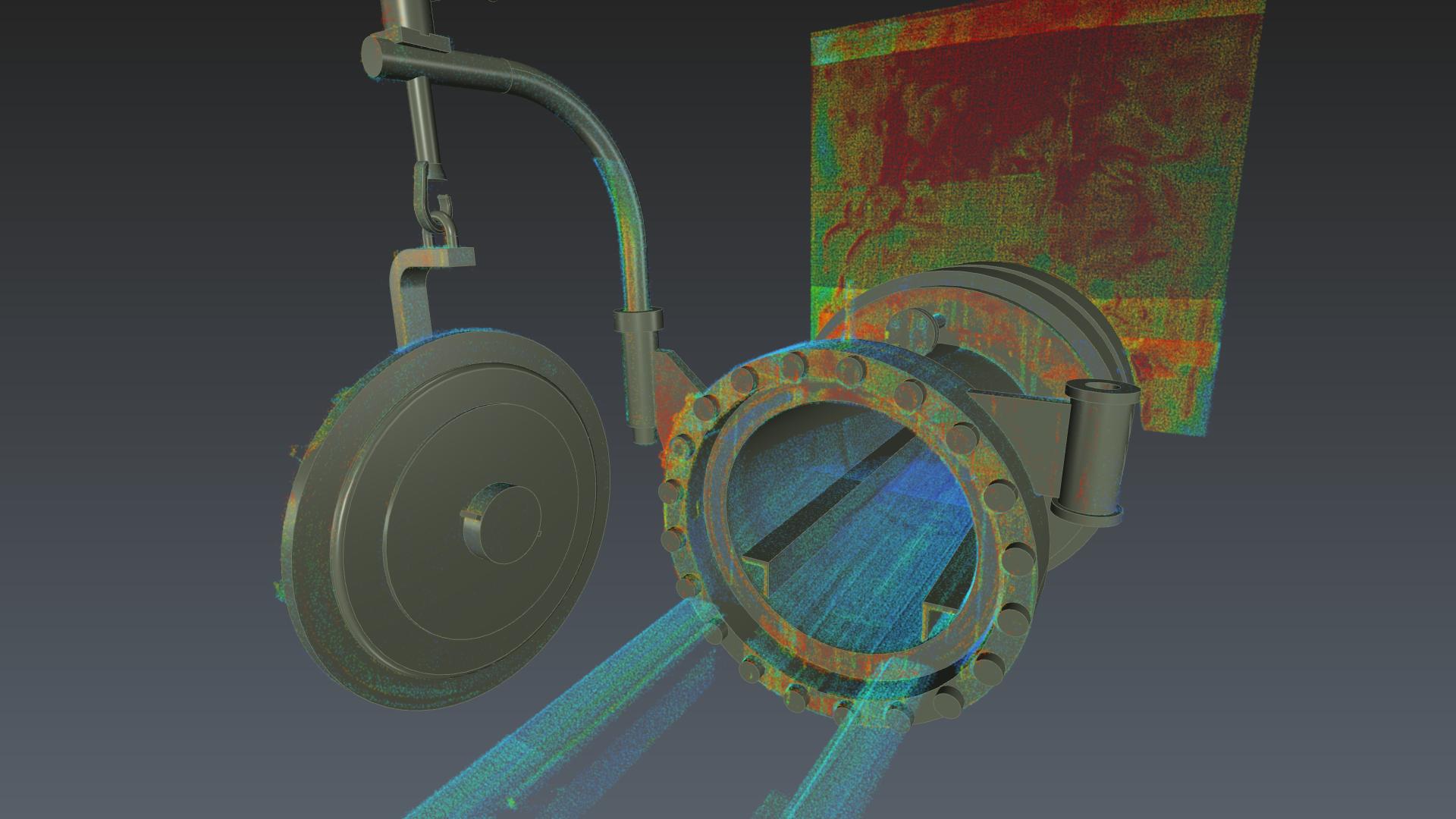
Detailed 3D point clouds with millimetric resolution and clarity
Measurement of vibration amplitude and frequency
Operational depth up to 4,000 meters with no external lighting required
Maximize Efficiency
Rapid scans of complex geometries and features in minutes
Real-time data processing enables informed decision-making in the field
Compressed data for streamlined storage, manipulation, and data transfer
Derisk Installations and Inspections
Contactless measurements from 10+ meters away decreases risk of damage to infrastructure, assets, and the environment
Inspections of subsea assets over time result in confident movement analysis
Data provides actionable intelligence to reduce maintenance costs and downtime
Kraken Robotics specializes in underwater data acquisition, providing unparalleled expertise and cutting-edge solutions to a diverse array of in water measurement challenges. From initial underwater survey planning to final data delivery, our comprehensive end-to-end approach and commitment to excellence has positioned us as industry leaders, empowering our clients worldwide with detailed and accurate three-dimensional point clouds which provide an insightful and holistic view of underwater environments. Common applications include:
Kraken Robotics revolutionizes the nuclear industry with our patented Nuclear LiDAR system, offering near real-time insights into as-found/as-left conditions of submerged and above-water assets. This technology surpasses traditional visual inspections and custom mechanical tools, providing non-contact, non-destructive, accurate as-built measurements and engineering-grade modeling. Our long-range laser scanning detects foreign materials and monitors asset conditions over time, aiding in maintenance planning and outage management. Common applications include:
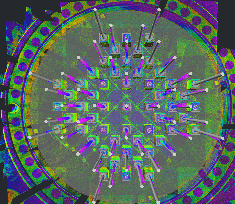
Core Alignment Verification
Reactor Inspections
Foreign Object Detection
Change Detection
Damage Assessment/Measurements
Predictive Maintenance
Below Core Plate Inspections
As-Built Scans/Digital Twin
Underwater Vessel Inspections
VT-1 and VT-3 Inspections
Integrated Approach to Mitigate Risk
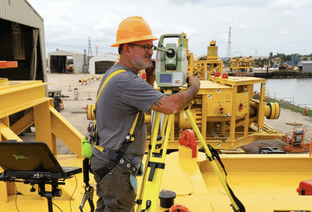
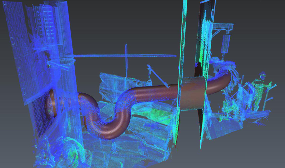
Using the latest technology from Leica Geosystems, in combination with dimensional control software and CAD packages, we generate comprehensive survey reports which document the as-built status of the surveyed asset. By strategically placing LiDAR registration targets on subsea assets, we can take the accuracy and quality of terrestrial measurements subsea by translating and combining the terrestrial point clouds with our own in-water LiDAR measurements through a combined registration. This innovative approach allows us to derive inferred measurements and produce incredibly detailed digital twins of submerged assets and their surrounding marine environment.
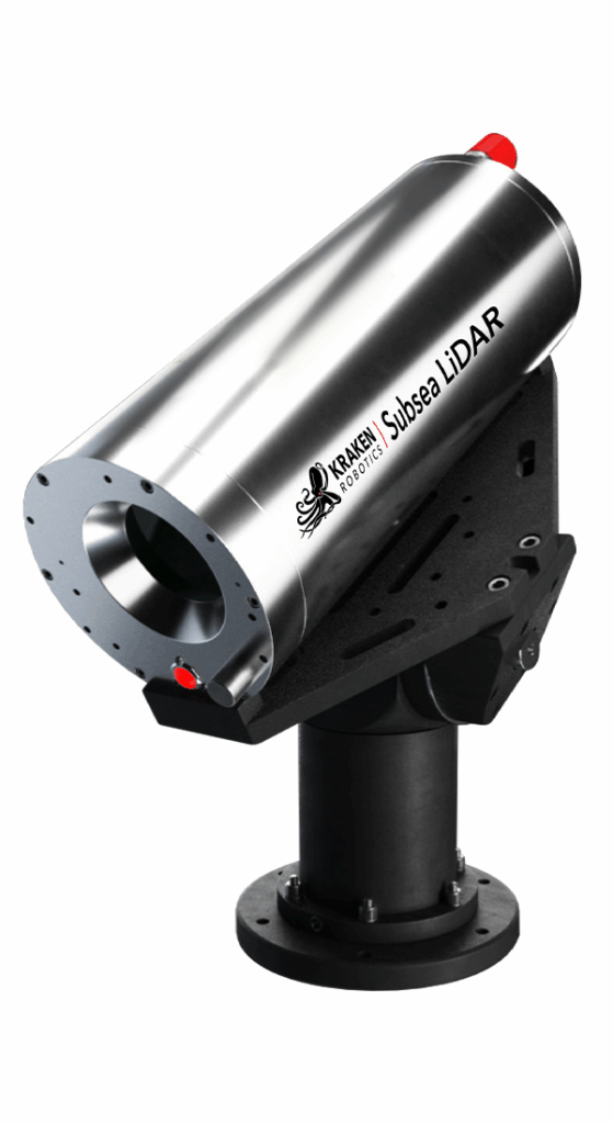
Our Technology
Subsea LiDAR Operational Parameters
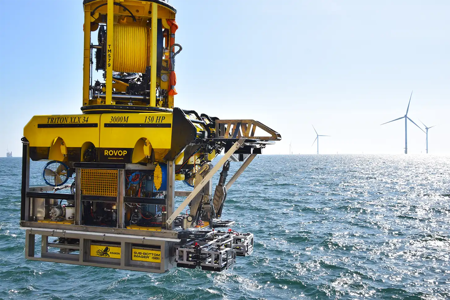
Deployment Methods: Tripod, Pole-mounted, ROV (Stationary or Dynamic), AUV, Diver
Range: Min 1 m / Max 45 m
(Turbidity dependent)
Field of View: 360° Pan 90° Tilt, 30° x 30° Sectors
Power Supply: 110V/220V AC PCI bottle included; 22V to 29V DC optional
Power Consumption: 130W with Pan Tilt @ 120 VAC; 80W without Pan Tilt @ 120 VAC
Ambient Lighting: Fully operational in bright sunlight and complete darkness
Operating Temperature: -5C to 35C
Data
Max Number of Points per Scan: Up to 14.4 million points per scan
Improved Range Precision <2.5 mm single-point @2-40 m, 1σ; <0.5 mm multi-point @2-40 m, 1σ
Angle Precision: <100µrad, horizontal and vertical (0.005°)
Data Transfer: Ethernet 1Gbps or 100 Mbps LAN; Internal 1TB SSD
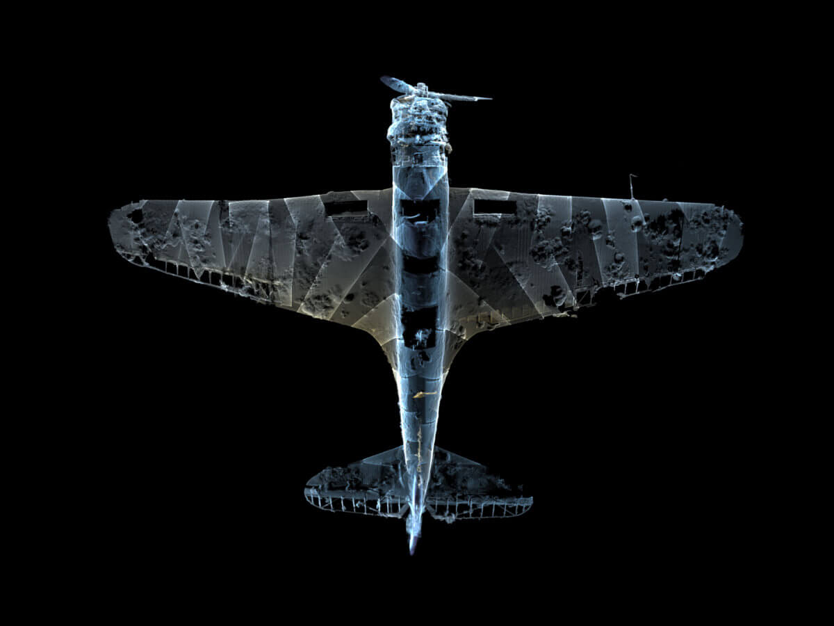
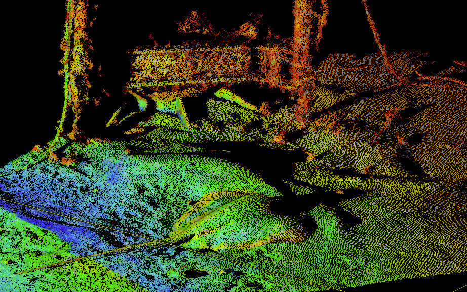
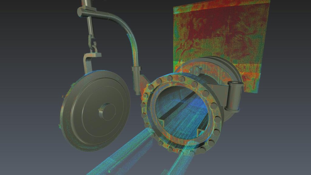
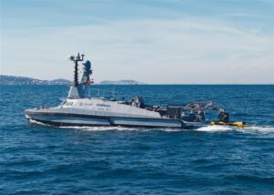
Gallery
For Customer Support or to Speak to One of Our Team


